Geodetic Co-ordinate System
The geodetic co-ordinate system is the most popular way of describing an absolute position on the Earth. It is made up of two angles, latitude and longitude, combined with a height relative to an ellipsoid.
Latitude and Longitude
Latitude is the angle that specifies the north to south position of a point on the Earth's surface, reported as ± 90°. Longitude is the angle that specifies the east to west position of a point on the Earth's surface, reported as ± 180°. The line of zero latitude is the equator, and the line of zero longitude is the prime meridian. See Latitude and longitude represented visually to describe a position on an ellipsoid.
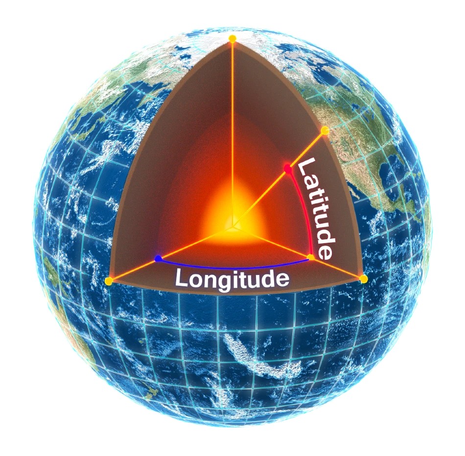
Latitude and longitude represented visually to describe a position on an ellipsoid
The figure below shows latitude and longitude on a map of the world, represented with a standard Mercator projection.

World map showing latitudes and longitudes
Latitude and longitude give the 2D point on the surface of the Earth. These are combined with height to give the 3D position on the Earth.
Height
Any height data output by Advanced Navigation devices is the height referenced the WGS84 reference ellipsoid. The WGS84 reference ellipsoid is a smooth mathematical model that approximates the form of the surface of the earth. The ellipsoid height (as used by GNSS) is not referenced to mean sea level; the height from the EGM96 geoid (orthometric height) approximates the height above mean sea level (MSL).
See Orthometric, ellipsoid and geoid height diagram below for a visual representation of geoid height, ellipsoid height and orthometric height (height above mean sea level).
Note:
Ellipsoid height refers to the height of a point of interest referenced to the WGS84 reference ellipsoid.
Geoid height refers to the height of the EGM96 geoid referenced to the WGS84 reference ellipsoid at a point of interest.
Orthometric height is the height at a point of interest referenced to the EGM96 geoid.
All heights can be either positive or negative dependant upon direction from the reference surface.
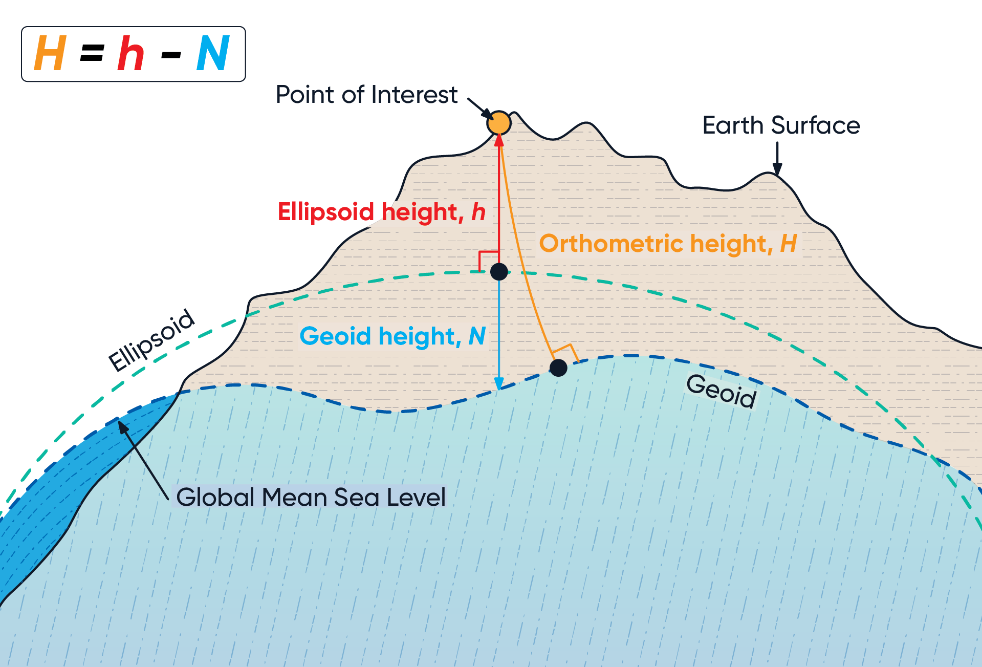
The value required to convert the WGS84 ellipsoid height to orthometric height can be found in the geoid height packet, see Geoid Height Packet.